
REVIEW · SCENIC HELICOPTER FLIGHTS
Wānaka: Scenic Helicopter Flight Wānaka Max
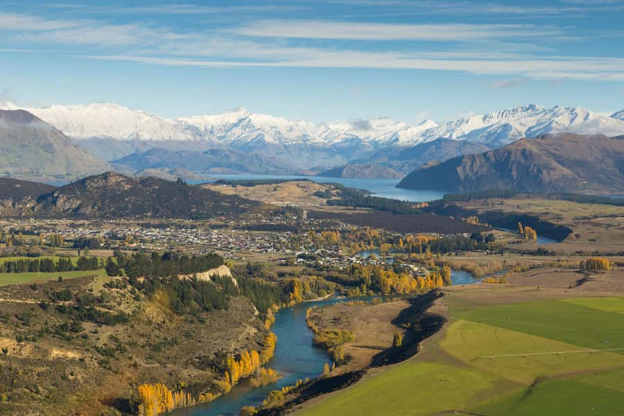
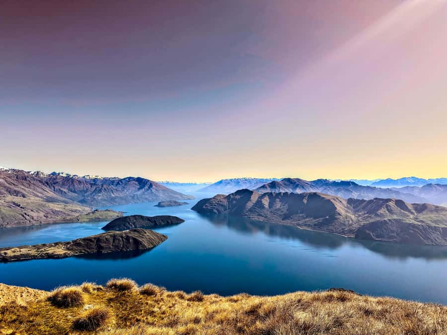
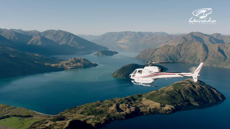
This is Wānaka from the sky. The Wānaka Max flight packs two alpine landings into 45 minutes, with wide views of the Matukituki River, Mount Aspiring, Lake Hāwea, and the remarkable lake within a lake on Mou Waho. I especially like the chance to land at Coromandel Peak, also known as Mt Roy, and the small-group feel praised by guests who flew with pilots such as Travis.
The main consideration is weather. Mountain flights can be postponed or cancelled because of conditions or pilot availability, and Coromandel Peak is available only when conditions allow. At $298 per person, this is a major splurge, but you are paying for access to views that would take much longer to reach on foot.
Key points to know before booking
- Two alpine landings: The 45-minute Wānaka Max flight includes two mountain landings, giving you time on the ground as well as views through the helicopter windows.
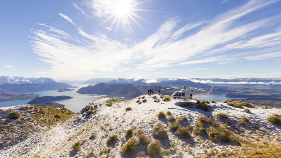
- Coromandel Peak at 4,000 feet: If conditions allow, you land at one of Wānaka’s most famous viewpoints, with views over Lake Wānaka and the town.
- Mou Waho’s lake within a lake: From the air, you can see a small inland lake on Mou Waho Island, a protected nature reserve.
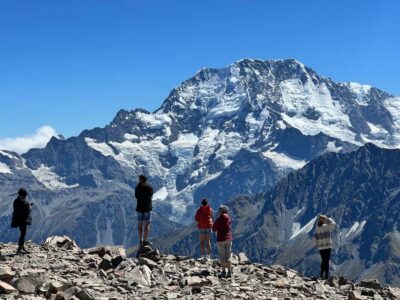
- Mount Aspiring National Park: Snow-covered peaks and glacier-carved valleys form the most dramatic part of the flight.
- A full regional circuit: The route also takes in the Matukituki River, Lake Hāwea, Stevensons Arm, and Wānaka township.
- Weather affects the plan: Your booking is not fully confirmed until Wanaka Helicopters contacts you, normally within 24 hours.
Why Wānaka Max is worth considering
Wānaka already has excellent views from the ground. You can look across Lake Wānaka, walk beside the water, and hike toward Mt Roy. The helicopter adds something different: scale.
From above, the lake, river valleys, ridges, and snowy peaks fit together in one view. You are not simply looking at a mountain. You are seeing how the mountain feeds the river, how the river cuts through the valley, and how the valley opens toward the lake.
I like that this is not just a short flight over town. The route reaches several distinct parts of the region, including the Matukituki Valley, Mount Aspiring National Park, Mou Waho, Lake Hāwea, and Stevensons Arm. The two landings also break up the flight, so you get a chance to step outside and take photographs rather than spend the full 45 minutes looking through glass.
The drawback is simple: $298 is a serious price. This is not a casual add-on for most budgets. You should choose it if the mountains are a central reason for your South Island trip, or if you want a high-impact experience without committing to a long mountain hike.
More Scenic Helicopter Flights in New Zealand
- Mount Cook: Scenic Helicopter Flight with Alpine Landing
★ 4.8 · 442 reviews - Bay of Islands and Hole in the Rock Scenic Helicopter Tour
★ 5.0 · 115 reviews - Fox Glacier: Scenic Helicopter Flight with Snow Landing
★ 4.7 · 107 reviews
Starting at Wanaka Helicopters
You meet at the Wanaka Helicopters office. The experience includes a live English-speaking guide, usually the pilot, who points out notable places during the route.
The preflight stage appears to be straightforward. One guest described the welcome and check-in as smooth, while another praised the pilot for drawing attention to special points along the way. That matters on a scenic flight. The views are strong on their own, but a good pilot helps you understand what you are seeing.
You should allow some flexibility in your day. Although the duration is 45 minutes, the operator may need to move the flight because of weather or pilot availability. Your reservation through GetYourGuide is not the final flight confirmation. Wanaka Helicopters confirms the time within 24 hours of booking and does its best to meet your requested departure time.
That arrangement is normal for mountain flying, but it can affect a tight itinerary. I would avoid scheduling a bus tour, flight, or important dinner immediately afterward.
The Matukituki River and the road into the mountains
Once airborne, the helicopter heads over the Matukituki River valley. This is one of the most rewarding sections because the view changes quickly from Wānaka’s settled lakeside setting to a broad alpine valley framed by steep peaks and native bush.
From the air, the river becomes a clear route through the countryside. You can see how the valley narrows and widens, with ridges rising on both sides. The helicopter gives you a sense of the area’s remoteness that is difficult to get from town.
The route is also a useful introduction to the scale of the region. Mount Aspiring National Park is not a single viewpoint or one isolated peak. It is a huge area of valleys, glaciers, rivers, and high country. A flight lets you see several parts of it in a short time.
For photographers, this section offers changing angles rather than one fixed panorama. You may want to keep your camera ready, but remember that reflections and window angles can affect photographs. The best images often come during the landings, when you can shoot without the helicopter window between you and the view.
Coromandel Peak, also called Mt Roy
The first major highlight is the possible landing at Coromandel Peak, also called Mt Roy. At about 4,000 feet, this viewpoint gives you a broad look over Lake Wānaka, the township, and the surrounding mountains.
This is the part of the experience that receives the strongest praise. One guest called landing on Mt Roy the highlight of a two-and-a-half-week New Zealand trip. Another described the two mountain landings as the real high point of the flight.
The appeal is easy to understand. Hiking Mt Roy takes time and effort, while the helicopter puts you at a high viewpoint within minutes. You still get the mountain setting, the cold alpine air, and the wide panorama, but without giving up half a day or more to a strenuous walk.
There is an important qualification: the Coromandel Peak landing depends on availability and conditions. Do not book this flight assuming that the landing is guaranteed. Mountain weather can change, and the pilot must make the final call.
If you do land there, you should have time to take photographs and look around before returning to the helicopter. The view over Lake Wānaka is the main attraction, with the town appearing small below and the surrounding peaks spreading out beyond it.
Same place, a different flight path:
- Franz Josef Glacier: Helicopter Flight & Alpine Landing
★ 4.8 · 619 reviews - Franz Josef Glacier Heli-Hike
★ 4.5 · 618 reviews - Heli Hike Fox Glacier
★ 5.0 · 563 reviews - Franz Josef: 35min Helicopter Trip over Two Glaciers
★ 4.8 · 451 reviews
Mount Aspiring National Park from the air
The flight continues toward the snow-capped peaks and glacier-carved valleys of Mount Aspiring National Park. This area has World Heritage status, and from the helicopter you can appreciate why it carries such importance.
The park’s character is shaped by rock, ice, water, and distance. Snowfields sit above dark ridges. Valleys cut between the peaks. Rivers run through areas where roads and buildings are absent. From ground level, you usually experience one valley or trail at a time. From the helicopter, the whole system becomes easier to understand.
I find this especially valuable if you do not have time for a long backcountry trip. The flight cannot replace hiking in the park, but it gives you a strong visual sense of its size and character without requiring specialist equipment or several days in the mountains.
The view is also likely to be the most weather-dependent part of the route. Clouds can hide high peaks even when conditions near Wānaka look fine. That is another reason to keep your schedule flexible and to treat the final route as dependent on the pilot’s judgment.
Mou Waho and the lake within a lake
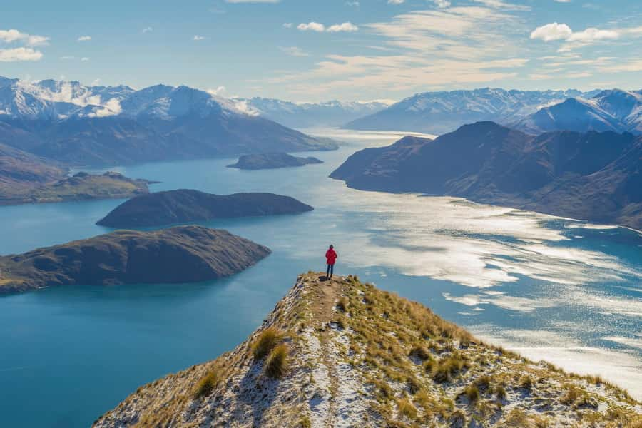
One of the most unusual sights is Mou Waho Island, a protected nature reserve in Lake Wānaka. From above, you can see its inland lake, creating the memorable effect of a lake within a lake.
This is not just a pretty aerial detail. It is the sort of geographical feature that can be hard to grasp from a map but instantly clear from the air. You see the island surrounded by Lake Wānaka, then the smaller body of water sitting on the island itself.
The description of the flight presents Mou Waho as a sight viewed from above, not as a promised landing location. That distinction matters. The Wānaka Max includes two alpine landings, but you should not assume that you will get out on Mou Waho Island.
Mou Waho also gives the route a change of mood. The mountain peaks are dramatic and vertical. The island and its inner lake create a quieter, more unusual pattern below. It is a good example of why the flight works as a regional overview rather than simply a trip to one summit.
Lake Hāwea and Stevensons Arm
The return section takes in Lake Hāwea and Stevensons Arm. These waterways look different from Lake Wānaka, and seeing them from above helps you compare their shapes, colors, and surrounding ridges.
The helicopter passes through Stevensons Arm while the pilot points out views of Lake Hāwea. This part of the circuit adds variety after the high mountain scenery. You move from snowy peaks and river valleys to broad water and more rugged slopes around the lake.
I like the contrast because it stops the flight from feeling repetitive. A scenic flight can become a series of similar mountain views, but the route here keeps changing. First there is the river valley, then the summit viewpoint, then the national park, Mou Waho, Lake Hāwea, and finally the town.
As you return toward the airport, you get a sweeping perspective of Wānaka township. After seeing the region’s remote mountains and large waterways, the town looks connected to a much bigger setting.
What the pilot adds
The pilot is both your aviator and your guide. The flight is conducted in English, and specific praise has gone to pilots who explained notable points rather than simply flying the route in silence.
Travis was singled out as an excellent pilot and guide. Other guests described their pilots as friendly and helpful, with one saying the pilot drew attention to special points throughout the flight.
That personal element is important on a 45-minute trip. You do not have unlimited time to identify every peak or valley yourself. Clear commentary helps you make sense of the route, especially when several mountain ranges and waterways come into view at once.
The quality of the flight still depends on the weather and the pilot’s decisions. If conditions require a change, the safest and most sensible response is to accept the revised plan. The goal is not to force a particular photograph or landing. It is to enjoy the best and safest version of the mountain flight available that day.
Price, timing, and practical value
The cost is $298 per person. Meals and drinks are not included, though that is not a serious issue for a 45-minute flight.
The real question is what you are comparing it with. A hike to a high viewpoint may cost less but requires more time, physical effort, and suitable weather over a longer period. A helicopter flight gives you access to several separate areas in one outing, along with the possibility of landing at Coromandel Peak.
I would consider the price good value for a special occasion, a honeymoon, a once-in-a-lifetime South Island trip, or anyone who places mountain scenery near the top of the itinerary. It is less persuasive if you are mainly looking for a quick activity between other low-cost outings.
The booking terms provide some useful protection. You can cancel up to 24 hours before departure for a full refund, and you can reserve now and pay later. Those options help because mountain weather can make planning uncertain.
The experience is wheelchair accessible, and smoking is not allowed. Starting times vary, so you need to check availability when booking. The operator also offers skip-the-ticket-line access, although the main practical benefit here is the organized check-in rather than avoiding a major queue.
Who should book Wānaka Max?
I would recommend this flight to you if you want to see the Wānaka region in a short period and are comfortable paying for access and convenience. It suits photographers, first-time visitors, couples marking a special trip, and anyone who cannot or does not want to hike to a high viewpoint.
It is also a strong choice if you have limited time in Wānaka. The route gathers many of the area’s defining sights into one flight, including Mount Aspiring National Park, Mou Waho, Lake Hāwea, Stevensons Arm, and the Matukituki River.
You may want to think twice if you dislike flying, need a guaranteed Mt Roy landing, or have a tightly fixed schedule. The scenery is the reason to book, but mountain weather controls what you can see and where you can land.
Should you book the Wānaka Max flight?
Book it if the view from Coromandel Peak appeals to you, the idea of seeing a lake within a lake sounds worth the price, and you want a compact introduction to the mountains around Wānaka. The combination of two alpine landings and a broad regional route gives the flight more substance than a short loop over town.
I would not book it solely because you expect a guaranteed Mt Roy landing. Think of that landing as a major possibility, not a promise. If you can accept that flexibility, Wānaka Max offers one of the most efficient ways to see the area’s rivers, lakes, snowy peaks, and remote valleys in a single outing.
FAQ
How long is the Wānaka Max helicopter flight?
The flight lasts 45 minutes.
How much does the experience cost?
The listed price is $298 per person.
Where does the flight begin?
You meet at the Wanaka Helicopters office.
Does the flight include a landing at Coromandel Peak?
The flight includes a landing at Coromandel Peak, also known as Mt Roy, if the landing is available. Weather and other operating conditions can affect the plan.
What sights can I see during the flight?
The route includes views of the Matukituki River, Mou Waho Island, Mount Aspiring National Park, Lake Hāwea, Stevensons Arm, and Wānaka township.
Is the experience wheelchair accessible?
Yes, the experience is listed as wheelchair accessible.
Just added around New Zealand
- Wellington: Scenic South Coast Discovery Helicopter Flight★ 4.8 · 4 reviews
- Wanaka: Scenic Helicopter Flight with Glacier Experience★ 5.0 · 42 reviews
- Wānaka: Heli Siberia – Helicopter Flight, Hike & Jet Boat★ 4.6 · 4 reviews
- Wānaka: Heli Siberia Max – Helicopter Flight, Hike, Jet Boat★ 5.0 · 3 reviews
- Wānaka: Helicopter Scenic Flight Wānaka Experience★ 5.0 · 4 reviews
- Wharekauhau Heli-lunch from Wellington★ 4.5 · 6 reviews
- 15-Minute Wellington Harbour Helicopter Flight★ 4.0 · 9 reviews
- Bay of Many Coves, Marlborough Sounds- Heli-lunch from Wellington★ 5.0 · 8 reviews
Scenic Helicopter Flights, compared.
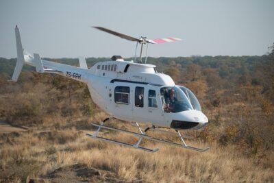
Helicopter Scenic Flight over Victoria Falls 12-13 minutes Flight
Read our review →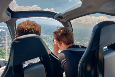
Niagara Falls, Canada: Scenic Helicopter Flight
Read our review →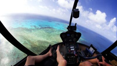
Great Barrier Reef Cruise & Scenic Helicopter Flight
Read our review →
Browse the lists this tour appears in