
REVIEW · NATIONAL PARKS
Ultimate Small Plane Aerial Tour to See Badlands National Park
See the Badlands from a new angle. This one-hour flight from Wall Municipal Airport gives you broad views of the park’s ridges, valleys, colorful formations, and remote prairie in a single outing. I especially like the longer aerial route and the chance to hear local stories from Ana, the pilot and owner of Fly Badlands.
I also like the personal feel. This is a private flight, with noise-dampening headsets, time for photos, and a souvenir Polaroid to take home. The main consideration is weather: flying is dependent on good conditions, and the $359 price is listed for a group of up to one, so you should confirm the exact party pricing before booking.
Key points to know before you book
- The flight lasts about 1 hour and 5 minutes, giving you more time above the park than a quick scenic pass.
- Ana serves as both pilot and guide, with praise for her calm manner, local knowledge, and care with first-time flyers.
- The route reaches well beyond the main Badlands formations, with views toward Yellow Mounds, Sage Creek Wilderness, White River Valley, and Sheep Mountain Table.
- You may spot wildlife from above, especially across the open prairie and remote areas of the park.
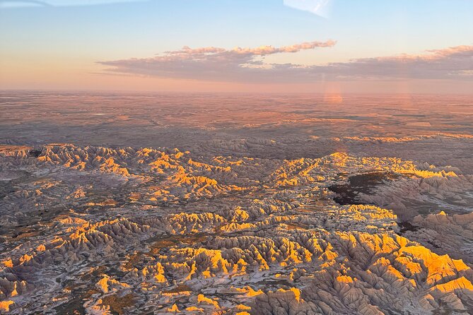
- Sunset flights can bring out strong colors, particularly around the striped and sculpted formations.
- Your package includes a Polaroid and a free branded T-shirt, adding two useful souvenirs to an already photo-friendly trip.
Why seeing the Badlands from the air changes the park
From the ground, Badlands National Park is a series of sharp overlooks, winding roads, and short walks among eroded rock. From a small plane, the park makes more sense as a whole. You can see how the ridges run, where the valleys open, and how the colorful formations give way to broad grassland.
That wider view is the real reason to book this flight. A roadside overlook gives you one framed scene. An aircraft lets you watch the scenery change from minute to minute. One moment you are above pale ridges and deep cuts in the earth. Soon after, the view opens toward prairie, tables, valleys, and distant ranch country.
I like that the flight is not limited to one famous viewpoint. The route can include the North and South ridges, Burns Basin, White River Valley, Saddle Pass, and Bigfoot Pass. It also reaches sites that are harder to appreciate on a normal drive, including the Sage Creek Wilderness and Badlands Gunnery Range.
The flight lasts roughly 65 minutes. That matters here. The Badlands is spread out, and a shorter flight could give you only a quick look at the central formations. This longer outing gives the pilot time to cover more ground and gives you more chances to watch for animals, changing light, and unusual rock shapes.
More National Park Flights in the USA:
- ATV Tour of Lake Mead National Park with Optional Grand Canyon Helicopter Ride
★ 5.0 · 102 reviews - 55 Mile – Helicopter Tour Around Zion National Park
★ 4.5 · 73 reviews - Denali National Park: Helicopter Flight with Glacier Landing
★ 5.0 · 64 reviews
From Wall Municipal Airport into the open sky
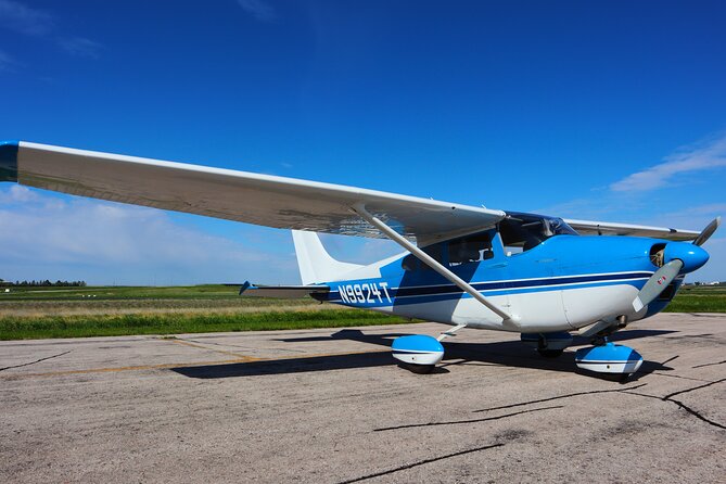
You meet at Wall Municipal Airport in Wall, South Dakota. The airport is a practical starting point because Wall is a gateway town for the park, and the tour returns to the same place after the flight.
The experience is private, meaning only your group takes part. That can make a big difference in a small aircraft. You do not need to share the flight with a busload of strangers, and the pilot can focus on your group’s comfort and questions.
The aircraft itself is part of the character of the outing. One account describes flying in Betty, a 1961 Cessna. That detail gives you a good sense of the experience: this is not a large sightseeing plane with rows of seats and a scripted announcement. It is a small-aircraft flight with a closer connection to the pilot and the view.
If you have never flown in a small plane, tell Ana at the start. One first-time passenger described feeling calm and cared for from takeoff through landing. Noise-dampening headsets are provided, which should make it easier to hear the pilot while reducing the engine noise.
Snacks and drinks are available for purchase, but they are not included. I would treat the airport as the place to buy anything you want before departure, rather than counting on refreshments as part of the tour.
The North and South ridges from above
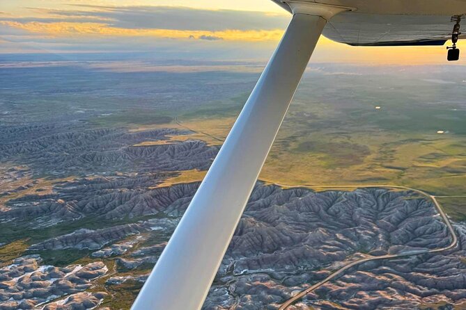
The central Badlands formations are the visual heart of the flight. From above, the North and South ridges show the park’s sharp edges, striped colors, and deep folds more clearly than they do from one roadside stop.
Look for the contrast between the pale rock, yellow bands, darker layers, and green prairie. The Badlands changes color with the angle of the sun, so the same formation can look muted in one direction and bright in another.
Yellow Mounds are especially useful for understanding this color shift. Their golden tones are easy to spot from the air, and they help break up the gray and tan rock that dominates some parts of the park.
Burns Basin, Saddle Pass, and Bigfoot Pass add variety to the route. From the ground, each place is tied to a road, trail, or pullout. From above, you can see the shape of the basin and the way the passes cut through the formations.
For photography, this is where a small plane earns its price. You are not limited to the view from one overlook, and the changing angle can give you a series of images instead of one familiar postcard scene. Still, photography from an aircraft has limits. Reflections, window angles, and movement can make some shots tricky, so enjoy the view first and treat the camera as a bonus.
White River Valley, Interior, and the gateway country
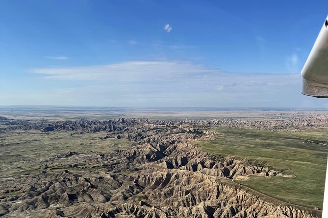
The tour also reaches toward Interior and the White River Valley. Interior is an important gateway to the park, and seeing it from above gives you a better sense of how the town, roads, river country, and park formations fit together.
The White River Valley brings a softer counterpoint to the jagged ridges. The Badlands is not one continuous wall of rock. It is a meeting of eroded formations, open grass, river valleys, and wide prairie. That change in texture is one of the most useful things to see from the aircraft.
Sheep Mountain Table offers another broad view. Tables are high, flat-topped areas that contrast with the sharply cut formations nearby. From a car, you may notice a table as a distant feature. From the air, you can see its shape and position in relation to the surrounding country.
Toadstool Rock adds a more familiar, almost playful landmark to the route. The name comes from its mushroom-like form, and it is the kind of unusual feature that is easy to appreciate from above. The aerial view helps you spot how isolated formations sit within the larger rock field.
A few more helicopter flights around the USA worth a look
- New York City: Manhattan Helicopter Tour
★ 4.7 · 7,076 reviews - NYC: Manhattan Sightseeing Helicopter Tour
★ 4.8 · 5,826 reviews - Las Vegas Helicopter Night Strip Flight Tour with Optional Dinner
★ 4.5 · 5,693 reviews - Grand Canyon Village: Helicopter Tour & Hummer Tour Options
★ 4.7 · 2,586 reviews
Prairie dogs, archaeology, and remote country
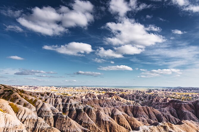
This flight is not only about rock formations. The route may include Quinn Road Prairie Dog Town, where open ground can reveal clusters of prairie dog activity. From the air, you may not see every animal clearly, but the broader pattern of the town can be interesting.
You may also pass The Pig Dig, an archaeological site. It adds a human and scientific layer to the trip. The Badlands is famous for dramatic geology, but its exposed rock and sediment also preserve evidence of ancient life. Seeing the site as part of the wider terrain helps place it in context.
Sage Creek Wilderness offers some of the most open scenery on the route. This is the sort of place where the view can stretch far beyond the formations, with prairie running toward the horizon. That openness may appeal to you if you like quiet scenery more than landmark collecting.
The Badlands Gunnery Range is another distinctive sight listed along the route. Its presence is a reminder that the region is not only parkland and tourist viewpoints. The surrounding area has working, military, ranching, archaeological, and natural uses. An aerial tour can reveal those different pieces without requiring a long drive between them.
Sunset flights and the best light
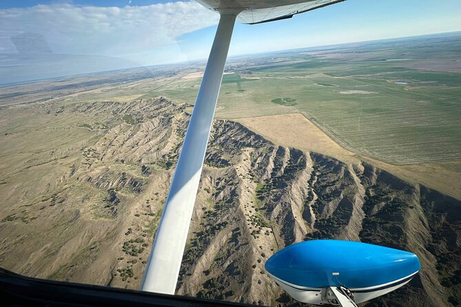
The flight can be especially appealing near sunset. One passenger described the colors as a highlight, and that makes sense in a park built around layered rock and changing tones.
Late light can bring out the bands in Yellow Mounds and the ridges. Shadows also sharpen the cuts and gullies, giving the formations more depth. If you are choosing among available times, a sunset departure may offer the most dramatic photographs.
There is a tradeoff. Light changes quickly, and the experience depends on weather. A cloudy or hazy evening may not deliver the strong colors you hope for. Since the tour requires good weather, the operator may need to move the booking or cancel it if conditions are unsuitable.
I would not book a sunset flight only for a perfect photograph. Book it because you want a calmer, changing view of the park. The best result may be a mix of bright color, soft prairie, and shadows spreading across the ridges.
Ana’s role makes the flight feel personal
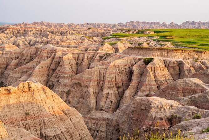
The pilot matters greatly on a small-plane tour. Ana is described as calm, professional, friendly, and well informed about both aviation and the Badlands. Several details point to the same strength: she explains what you are seeing, helps nervous passengers feel safe, and works to keep the outing enjoyable.
One account describes last-minute help when weather caused problems. Another describes a spontaneous booking arranged quickly. That does not guarantee the same flexibility every time, but it suggests a hands-on operation rather than a large company with rigid procedures.
Ana is also the owner and operator of Fly Badlands. That can give the tour a more personal feel. You are not simply being placed into a vehicle while someone follows a script. The pilot’s own enthusiasm for the area becomes part of the outing.
Families may appreciate this approach. One family had children asking to return the following summer. Still, remember that this is a small aircraft, so your group should be comfortable with a compact setting and an hour in the air.
Is $359 a fair price?
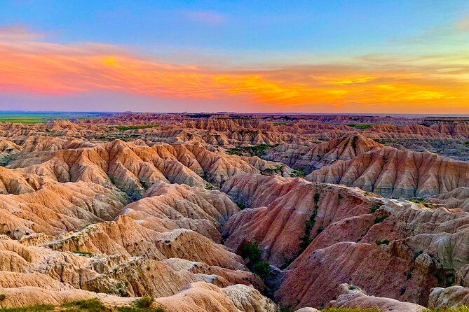
At $359 per group, the price is not a casual add-on for most park visitors. You should compare it with your wider South Dakota plans and ask how much value you place on seeing the park from an angle that roads cannot provide.
The value is strongest if you have limited time, enjoy photography, or want a special experience for a birthday, anniversary, or family trip. You cover a large area in about 65 minutes, with a private aircraft, a pilot-guide, headsets, an aerial route, and a Polaroid included.
The free branded T-shirt is a nice extra, but it should not decide the booking. The main purchase is the flight and Ana’s guidance. Snacks and drinks cost extra, and tips are optional.
The pricing description says the $359 fee is for a group of up to one. Because that wording is unusual for a private group tour, I would confirm the total cost before paying, especially if you are booking for more than one person. That simple check can prevent an unpleasant surprise.
What you take home besides photographs
The tour includes a souvenir Polaroid. Unlike a phone photo that can disappear into a crowded camera roll, a printed image gives you something immediate to keep or display.
You also receive a free branded T-shirt. It is a practical souvenir and a reminder of the flight, though sizing and shirt choices are not specified. If you care about those details, ask before departure.
The aerial views themselves are the main keepsake. You may want to bring your own camera or phone, but do not let photography distract you from looking out the window. The best parts of the flight may arrive between the shots you planned.
Booking, weather, and who should choose it
You receive confirmation at booking in most cases. If you book within 12 hours of departure, confirmation comes as soon as possible and depends on availability.
Free cancellation is available up to 24 hours before the start time. Changes or cancellations inside that 24-hour window are not accepted for a refund. If bad weather cancels the flight, you can receive a different date or a full refund.
I would book this for photographers, first-time flyers who want a guided introduction to small aircraft, families looking for a memorable outing, and anyone who has already seen the park from the road and wants a fresh view.
I would skip it if you are uncomfortable in a small plane, need a guaranteed departure in uncertain weather, or prefer a low-cost park activity. The flight is also less useful if you want hiking time, close views of the formations, or a quiet ground-level walk. It shows you a great deal, but it does not replace time inside the park.
Should you book the Badlands aerial tour?
Book it if the Badlands is a major part of your South Dakota trip and you want to understand its full shape, not just collect a few overlooks. The private format, longer flight, local guidance from Ana, and broad route make this more than a quick pass over the park.
The strongest case is the combination of scenery and personal service. You get the North and South ridges, valleys, prairie, archaeological sites, and remote areas in one flight, with a pilot who takes an active role in your comfort.
Just confirm the unusual group pricing, allow room for weather changes, and bring realistic expectations about small-plane photography. For the right passenger, this can be one of the most memorable ways to see Badlands National Park.
FAQ
Where does the aerial tour begin?
The tour begins at Wall Municipal Airport in Wall, South Dakota, at ZIP code 57790.
Where does the tour end?
The flight ends back at Wall Municipal Airport, the meeting point.
How long does the flight last?
The experience lasts approximately 1 hour and 5 minutes.
Is this a private tour?
Yes. Only your group participates in the activity.
What is included?
The tour includes a souvenir Polaroid, noise-dampening headsets, and photo opportunities on the ground and in the air. Each guest also receives a free branded T-shirt.
Is food included?
No. Snacks and drinks are available for purchase, but they are optional and not included in the tour price.
What happens if bad weather cancels the flight?
If poor weather causes a cancellation, you will be offered a different date or a full refund.
Just added around the USA
- Zion National Park, Canaan Cliffs: Extended Helicopter Tour★ 4.5 · 4 reviews
- Zion National Park and Canaan Cliffs: Helicopter Tour★ 4.7 · 22 reviews
- West Maui and Molokai Special 45-Minute Helicopter Tour★ 5.0 · 9 reviews
- Oahu: Waikiki 20-Minute Doors On / Doors Off Helicopter Tour★ 4.9 · 32 reviews
- Waikoloa: Big Island Spectacular Helicopter Tour★ 4.5 · 5 reviews
- Las Vegas: Valley of Fire Helicopter with Scenic Landing★ 5.0 · 2 reviews
- Greater Yellowstone Trifecta Aerial Tour | 1-Hour Scenic Flight★ 5.0 · 6 reviews
- Hudson Valley Fall Foliage Helicopter Tour from Westchester (Shared)★ 4.0 · 2 reviews
National Parks, compared.
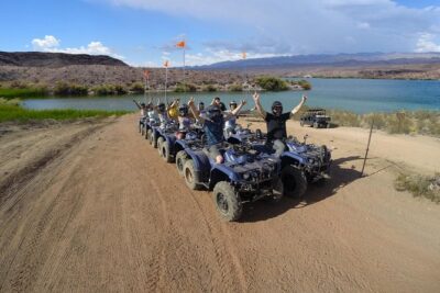
ATV Tour of Lake Mead National Park with Optional Grand Canyon Helicopter Ride
Read our review →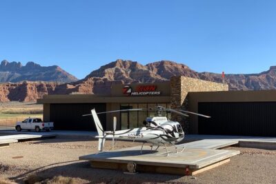
55 Mile – Helicopter Tour Around Zion National Park
Read our review →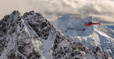
Denali National Park: Helicopter Flight with Glacier Landing
Read our review →
Zion National Park: 10- or 20-Minute Scenic Helicopter Tour
Read our review →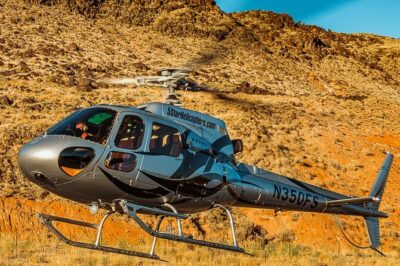
35 Mile – Zion National Park Panoramic Helicopter Flight
Read our review →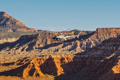
100 Mile Zion National Park Panoramic Helicopter Flight
Read our review →
Zion National Park and Canaan Cliffs: Helicopter Tour
Read our review →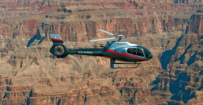
Phoenix: Grand Canyon National Park Tour & Helicopter Flight
Read our review →Browse the lists this tour appears in